


ANDERSON - T 1 Voting District, Iron County, Wisconsin
About
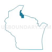
Outline

Summary
| Unique Area Identifier | 694098 |
| Name | ANDERSON - T 1 Voting District |
| County | Iron County |
| State | Wisconsin |
| Area (square miles) | 83.60 |
| Land Area (square miles) | 83.25 |
| Water Area (square miles) | 0.36 |
| % of Land Area | 99.57 |
| % of Water Area | 0.43 |
| Latitude of the Internal Point | 46.33370010 |
| Longtitude of the Internal Point | -90.46379300 |
Maps


Graphs
Select a template below for downloading or customizing gragh for ANDERSON - T 1 Voting District, Iron County, Wisconsin


Neighbors
Neighoring Voting District (by Name) Neighboring Voting District on the Map
- GORDON - T 1 Voting District, Ashland County, WI
- GURNEY - T 1 Voting District, Iron County, WI
- JACOBS - T 1 Voting District, Ashland County, WI
- KNIGHT - T 1 Voting District, Iron County, WI
- MORSE - T 1 Voting District, Ashland County, WI
- MORSE - T 2 Voting District, Ashland County, WI
- SANBORN - T 2 Voting District, Ashland County, WI
- SAXON - T 1 Voting District, Iron County, WI
Top 10 Neighboring County Subdivision (by Population) Neighboring County Subdivision on the Map
- Sanborn town, Ashland County, WI (1,331)
- Jacobs town, Ashland County, WI (722)
- Morse town, Ashland County, WI (493)
- Saxon town, Iron County, WI (324)
- Gordon town, Ashland County, WI (283)
- Knight town, Iron County, WI (211)
- Gurney town, Iron County, WI (159)
- Anderson town, Iron County, WI (58)
Top 10 Neighboring Unified School District (by Population) Neighboring Unified School District on the Map
- Ashland School District, WI (12,503)
- Chequamegon School District, WI (6,640)
- Hurley School District, WI (4,219)
- Mellen School District, WI (1,842)
Top 10 Neighboring State Legislative District Lower Chamber (by Population) Neighboring State Legislative District Lower Chamber on the Map
Top 10 Neighboring State Legislative District Upper Chamber (by Population) Neighboring State Legislative District Upper Chamber on the Map
Top 10 Neighboring 111th Congressional District (by Population) Neighboring 111th Congressional District on the Map
Top 10 Neighboring Census Tract (by Population) Neighboring Census Tract on the Map
- Census Tract 9507, Ashland County, WI (2,206)
- Census Tract 9400, Ashland County, WI (1,867)
- Census Tract 1802, Iron County, WI (1,493)
- Census Tract 9506, Ashland County, WI (1,391)